Running an aerial unit is one of the most expensive operational costs for any police or military control team. So it’s vital that the information that the unit gathers while in operations is not only accurate and data-rich but is also easy to disseminate back in the control room.
If the system works correctly, that real-time data can be assessed, analysed, and acted upon faster and more effectively. The data can also flow both up and down-stream, providing all teams with crucial information when it’s needed most.
Correct integration
To achieve this level of management, it’s essential to ensure that systems are correctly integrated. Fortunately, the development of augmented software and Decision Support systems capable of interoperating with a standard protocol such as STANAG 4609 and STANAG 4676. So what should your mission-planning and debriefing tools include?
- Planning – creating a mission in a supervised environment that identifies potential targets precisely means that your aerial operators make the best use of their time from the moment the helicopter takes off. For search and monitor operations, a grid system can be pre-programmed into the system, and accurate geospatial software ensures that the flight plan is followed precisely.
- Execution – once the helicopter is airborne, the mission can be flown as per the pre-planning stage and augmented reality capabilities can be overlaid on geospatial mapping to provide much richer levels of metadata. This can be immediately downloaded and sent back to the control centre for analysis and, if necessary, immediate action, allowing the mission parameters to be far more flexible and easily managed both on the ground and by the aircrew.
- Coordination with ground and air units – the easy transference of data, including that which has been enhanced by augmented reality or other data-gathering software such as LIDAR, infra-red or Electro-optical and Hyperspectral inputs, can be shared between units and even between different agencies where required. For example, combined operations between the Police and Border Control agencies can be coordinated more accurately for better on-the-ground responses.
- Debriefing – Using integrated systems and accurate data gathering, debriefing missions can be more precise, and conclusions and recommendations can be based on more accurate information. As the data has been electronically gathered, it can be stored for further analysis later on if necessary. Comprehensive data collation can also be used to generate automatic reports or, where required, validate the requirement for additional operations.
OPENSIGHT-ac Analyst Console
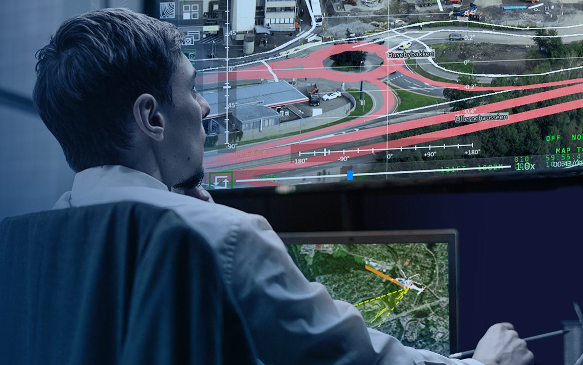
To process the sheer amount of data that can be acquired on a mission and to extrapolate the essential points from that data while filtering out the ‘noise’ that has no relevance, OPENSIGHT-ac Analyst Console has been developed to enhance and streamline the process.
The system can handle the extensive amount of STANAG 4609 data produced by an integrated collection system. By programming specific criteria into the search parameters, the Console can quickly and accurately identify what is relevant and what isn’t.
However, nothing is better than an experienced ‘pair of eyes’ on any situation. OPENSIGHT-ac Analyst Console allows operations managers and analysis experts to supervise real-time operations and liaise with pilots and airborne operators to adjust the mission based on real-time analysis.
As far as a decision support system goes, OPENSIGHT-ac Analyst Console takes things to the next level. It demonstrates how information sharing can be achieved quickly and in real-time operations – essential for the effectiveness of any operation, especially those involving airborne units. It also provides a cohesive and wide-ranging integrated system that works with STANAG existing data-collection systems, upgrading the data acquired with augmented data, georeferencing, and full motion video.
This level of sophistication ensures that operations can be planned, executed, and debriefed efficiently, regardless of the mission parameters or the number of agencies involved.
