Even though California is no stranger to wildfires that often sweep through the state, 2025 was a terrible year. In the first week of January 2025 alone, an unprecedented 55 Los Angeles wildfires devastated thousands of acres.
This time, the big difference wasn’t just the ferocity of the fires but their location. 2025 saw many neighbourhoods in Los Angeles razed to the ground, sometimes in minutes, and the human cost in lives, as well as devastated homes and businesses, will reverberate for generations.
The January 2025 LA fires are mostly extinguished—for now. But what were the causes, and how can firefighting and rescue teams prepare for the next wave of Santa Ana-driven fires? In this article, we’ll try to examine the causes and impacts of the fires and how modern technology is being used to identify, predict, and control fires using systems such as OPENSIGHT‘s emergency response systems.
We’ll also take a look at the future of fire and rescue operations. We’ll focus on how technology can combat the impact of these destructive fires, especially as climate challenges make ‘once-in-a-lifetime’ events such as the Los Angeles wildfires a more frequent occurrence.
What caused the LA fires?
Southern California is a particularly arid region, with narrow canyons and scrubland that can become tinder-dry during the early part of the year. This time, California had been in the grip of a prolonged drought, fuelled by climate change, that compounded conditions. There was very little ground moisture and dry vegetation, which gave the fires their first ingredient—fuel.
The Santa Ana winds, seasonal dry winds that blow from the Sierra Nevada mountains towards the ocean, exacerbated the situation by adding the second ingredient, oxygen.
All it then needed was an ignition to trigger devastating fires that were driven at high speed towards densely populated areas of LA. The use of timber to build houses and their proximity to one another without any natural or manmade fire brakes led to a firestorm that swept unchecked through entire neighbourhoods.
The individual fires were given names to identify them, and the two largest, the Palisades Fire in Pacific Palisades and the Eaton Fire in Altadena, are two of the largest single fires in California’s history. In total, at least 16 people have died to date.
While we may never know for sure what ignited each of the separate fires, the causes could range from arson to faulty electrical equipment or even a casually discarded cigarette.
What we do know, though, is that this ‘once-in-a-lifetime’ event is now likely to happen more regularly as the effects of climate change drastically alter the weather patterns of Southern California. Hot, dry, and windy conditions will become more commonplace. This means the 2025 LA wildfires may not be the only time we see this kind of devastation on such a large scale.
How technology helped to fight the fires
While the devastation was almost unimaginable, without the use of technology, it could have been much worse. Emergency response systems have come a long way in the last decade, and the use of equipment such as drones and AI has helped to keep the level of devastation and the death toll lower than in previous firestorms.
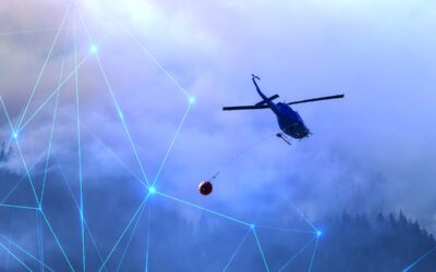
Drones and unmanned aerial units are capable of getting far closer to the fires than human operators and are, therefore, capable of mapping the spread of a fire more accurately. This enables disaster response coordinators to predict the path of a fire and evacuate anyone at risk. It also allows emergency response systems to be put in place to deploy firefighters and aerial water transporters to target the most effective points and halt the spread of the flames.
As part of a combined response, satellites were redirected to focus on the SoCal region, giving an eye-in-the-sky view of the terrain. Modern satellites provide highly detailed and multi-spectral images that can identify underground ‘hot spots’ even if the surface fire may appear to be fully damped down on the ground.
AI is also playing a part in firefighting, with both hardware and software that can detect smoke at great distances, notify firefighters, and give them an exact location to target.
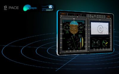
Modern platforms such as OPENSIGHT take this technological approach to fire fighting a stage further, allowing the integration of hardware and intuitive software to create a highly effective tool to combat events such as the Los Angeles wildfires.
From aerial imaging to preliminary damage assessment of key assets such as transport, power, and communication systems, image assessment, and the use of augmented reality to superimpose existing terrain data over devastated areas, rescue and fire services have a fighting chance against a dangerous and unpredictable enemy.
A technological approach to disaster management
In 2023, Cal Fire added AI and smoke detection hardware to the 1,114 cameras placed in high-elevation areas throughout the state, including on mountain peaks and hilltops. This alone enabled fire response teams to immediately identify and track fires, giving residents in at-risk areas time to escape.
Artificial Intelligence, combined with high-definition aerial imaging and tracking software, allowed airborne units to monitor the fires from a safe distance. By combining this with Enhanced Reality software such as OPENSIGHT, which overlays additional data levels onto terrain maps, SAR teams were able to scour areas that had been visually altered by the fire’s effects, making it faster and easier to identify locations and direct searches for missing individuals.
This real-time data allows for better prioritization of both firefighting efforts and evacuation plans, helping disaster response teams manage and maintain safe evacuation routes out of the danger zone.
This enhanced situational awareness through the use of 21st-century technology not only serves to protect the homes and lives of the public but also safeguards the well-being of emergency response teams and those at the frontline of the fires. Providing real-time support for aerial firefighting, such as directing water transporters to the most effective locations, is also part of AI and ER technology.
Combined with multi-spectral and hyper-spectral imaging to give firefighters an intimate understanding of a wildfire’s development, this tech has proven invaluable in saving lives and property.
Using AI to assess the aftermath
Once the flames have been extinguished, it’s time for damage assessment teams to move in. Once again, systems such as OPENSIGHT are helping fire and rescue services assess the level of damage at a location post-event. This information can then be integrated into libraries of information that may help combat future events.
Damage assessment teams, as well as those in charge of emergency preparedness and response, use various applications, including drones and aerial imaging, such as thermal imaging and preliminary aerial and satellite assessment. This tech is employed to map the course of the fire, the extent of the damage, and potential ways of preventing the same scenario from happening again.
The data can then be integrated and accessed by both human and AI programs in the future, providing an even faster and more effective targeted response. The bottom line is that the use of this highly advanced technology could mean that no more lives are lost in the event of new wildfires in the future.
This technology can also play a key role in forest management, for example, demonstrating where fire breaks should be positioned to prevent fires from jumping to new areas. It can also be used to assess areas of forests and canyons that need additional ground management to clear potentially volatile dry brush and scrub.
OPENSIGHT – in the future of emergency preparedness and response
As we move towards combining human and AI/AR technology to manage emergency situations, OPENSIGHT is continually delivering innovative yet intuitive solutions that can help firefighting, SAR, and disaster management operators operate more effectively.
Turnkey solutions such as Real-time Augmented Reality and Advanced Video Acquisition and Enhancement systems are effectively improving situational awareness for operators both in manned aerial platforms and through the use of remote uncrewed vehicles such as drones. Seamlessly integrating augmented and mixed reality into existing legacy systems, they provide operators and coordinators with a unique perspective that is updated in real-time.
By merging and overlaying data layers, airborne units can get an instant and accurate assessment of both the terrain and the conditions, making operations safer, more productive and more cost-effective and making every minute in the air count.
To learn more about OPENSIGHT, view our informative video presentations, or contact a member of our team to discuss your needs in more detail today.