Geospatial data is mission-critical to the operational performance of both military and civilian users. It is the foundation of all operations, from the exact location of a specified military target to topographical information to help in Search and Rescue missions.
Geospatial analytics is the process of collecting, analysing, and visualising data related to specific geographic locations, which can then be applied in real time to the operation’s parameters.
In this article, we will take a closer look at the role of geospatial analytics within carious operational scenarios. We’ll examine the different types of geo-data that can be recorded, combined and analysed, as well as its uses, benefits and real-word applications. We will also look at the role FlySight’s OPENSIGHT turnkey geospatial analytical solutions play in the modern world, with particular relevance to airborne operations.
What is geospatial analytics?
Geospatial data can be collected using various methods. At its most basic, the building block of all geospatial data analytics is the coordinates on the earth’s surface, which are relatively easy to gather.
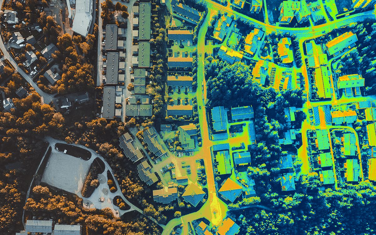
Once this has been done, additional data can be added to give the observer a more accurate and complex overview of the situation on the ground. A set of latitude and longitude coordinates will only give you a location. For example, it will not tell you if the area is urban or rural or what structures are located at that point. Additional data must be collected and added to the coordinates to do this. This information gives the observer a deeper understanding of the characteristics of the location as well as temporal information and multiple layers of data.
Both human operators and AI can then analyse this to extract the relevant data, which can then be passed back to the operators in the field.
The different types of geo-data that can be combined and analysed
Geospatial data has several key components. These geo-data packages can be combined with others an analysed to give a multi-layered overview.
Geographic information—This is the foundation layer of all multi-layered data sets, providing geographical coordinates from sources such a map, charts, and graphical representations.
Visual records—This data can include real-time visual observations as well as existing information from graphs and tools such as FlySight’s OPENSIGHT Consoles, which employ a variety of multi-spectral cameras and data-gathering technology.
Geospatial data – This is information that gives the observer details about objects and other features at a specific geographic location. This information is not necessarily permanent – it may include short-term static data such as an earthquake, forest fire or other natural disaster event, or dynamic data such as a moving vehicle target.
Geospatial data is often gathered from multiple sources, including satellite imagery, weather information, and multi-spectral visual data, particularly infrared data. This data can be added to other existing information, such as mobile phone data and census information, and then overlaid on a topographical map to give the observer an enhanced reality experience and additional real-time information.
The general benefits of geospatial data analysis
The amount of geospatial data that can be gathered is extraordinary. This can be an issue if the system is unable to process large amounts of data. However, thanks to the advent of AI (in conjunction with human operators), huge amounts of data can be quickly processed, relayed back to the user, and stored directly in the Cloud for easy access from anywhere in the world.
The storage system used for geospatial data analysis enables users to access closed systems, which can be used to store sensitive data securely, or open systems that provide generic info such as weather and geographic data.
Raw data no longer has to be analysed by trained professionals but can instead be rapidly dissected by AI systems. While human interaction has to be a part of the process, AI can effectively remove any background ‘noise’ and work to pre-defined search parameters that identify and extract relevant information while disregarding non-relevant data.
The resulting refined data can then be assessed by human operators and then passed to the end user – in many cases, aerial platform operators such as helicopter crews.
Other advantages of geospatial data analysis include giving organisations advance warning of potential changes or imminent issues. This is particularly relevant for operations involving disaster relief or anticipating how an infectious disease may spread on the ground (for example, mapping and predicting cases of Ebola in rural African locations).
It gives organisations a deeper understanding of how some analytical systems are more effective than others and what they can do to refine their processes. This, in turn, can provide organisations with far more effective and efficient systems.
Applications of geospatial data
Geospatial data can be continually updated so that the most relevant and up-to-date information is passed to the end user. This is particularly relevant in operations such as SAR, where a natural disaster may have significantly changed the topographical outline. It is also applicable for surveillance operations involving moving targets and highly fluid situations such as crowd control.
Geospatial data is mission-critical for the military, particularly for airborne operations in hostile environments. Because these situations can be incredibly fluid, having the most up-to-date data and the ability to analyse, process, and relay that information to operators in the field is crucial.
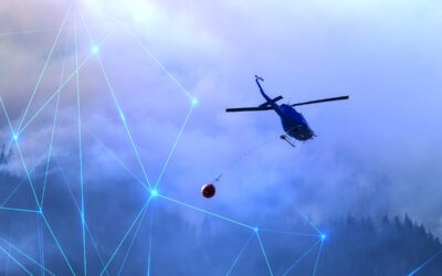
Real-time geospatial data is essential for SAR teams to identify and locate targets in highly challenging situations. For example, a SAR helicopter unit will need to know the exact weather conditions in its search area for the target’s safety and the operational safety of the vehicle and its crew.
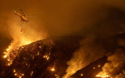
The same applies to firefighting applications, especially when teams are tasked with combatting forest wildfires. The data has to be relayed to both ground and air crews so that targeted responses can be made when hotspots appear. This would include the use of topographical data and existing maps as well as information gathered by multi-spectral imagery – particularly infrared.
For law enforcement, geospatial data analysis can assist in surveillance operations and crowd control. The fluidity of both scenarios requires a combination of data ranging from facial and number-plate recognition to maps and graphs. For urban surveillance, overlying data onto a topographical map can provide useful information such as the number of people registered to a particular address, the proximity of utilities, assessing heat signatures, etc.
For utilities services, geospatial data can be a huge benefit in identifying the precise location of underground pipes and cables in the case of a failure. It can also be used to assess the surrounding landscape, for example, directly beneath a dam or close to a major gas pipeline. In a worst-case scenario, this information can then be directly relayed to the emergency response teams to aid in rescue, recovery, and situation containment.
The future of geospatial data and analytics
Geospatial data analytics is at the cutting edge cutting of technology. The advent of Enhanced Reality and AI expands the usefulness and applications of this technology exponentially. As the system becomes more refined, it can be applied to a whole new array of uses, from assessing footfall through a retail business to analysing business markets to ensure the best geographical positioning of a new site. It can be applied to streamlining logistics, such as cargo movement by road, and optimising transportation in rural and urban areas. This can give town planners the data they need to move traffic more effectively and avoid congestion.
Geospatial data can also be applied to environmental monitoring, tracking, and predicting changes in the environment, such as the occurrence of deforestation and its effect on human settlements and the wider environment.
FlySight – at the forefront of geospatial data turnkey solutions
For airborne units, geospatial data is a key component of missions and needs to be both accurate and up-to-date. FlySight’s OPENSIGHT can be used to enhance the operational procedure as well as ensure a successful outcome. The system includes mission planning, operational and debriefing, allowing users to plan, fly and coordinate the process both in the air and on the ground.
The use of 3D Enhanced Reality provides human operators with instant access to multi-layered data, improving their situational awareness and allowing them to better understand the mission parameters, especially in highly fluid situations.
For more information on this and other FlySight’s unique industry solutions, get in touch today using our online contact form.


