One of the most significant issues that can face operations managers and coordinators is the problem of having too much information. What happens when you’re looking for a specific data point, but there’s so much background ‘noise’ and redundant data that the relevant information becomes lost?
Searching through massive amounts of metadata can not only be costly and time-consuming, but it can jeopardise the success of an ongoing operation. Information management systems need to be broad-ranging but tuneable so that specific data can be processed, identified and analysed quickly.
Information decluttering – less is more
When you’re running an operation where data is paramount, it’s vital to ensure you select the correct data. The objective is information decluttering – where any extra information that isn’t relevant to the operation is filtered out, allowing you and your analysis team to cherry-pick the data that actually matters.
In a real-time operation, this process must be done quickly and comply with the STANAG guidelines and regulations on data collection and analysis. Using an information management system such as OPENSIGHT allows mission coordinators to analyse, assess and dissimilate the data their airborne units gather.
This aids in the decision-making process and ensures that mission data analysis is carried out without the risk of missing that vital piece of information that could affect the outcome of the mission itself.
What is OPENSIGHT?
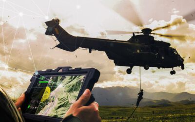
OPENSIGHT is a multi-platform PED providing processing, exploitation and dissemination of data. By integrating a geo-exploitation toolbox with augmented reality capability and the option to create multi-layer processing in real-time, OPENSIGHT allows you to gather, analyse and dissimilate data quickly and easily.
OPENSIGHT complies with all current STANAG guidelines and is based on over a decade’s worth of experience in software interfacing for airborne information processing.
How does it work?
OPENSIGHT uses modular plug-ins which can be customised to the user’s requirements. These plug-ins work symbiotically with similar applications, allowing the user to create a library of plug-ins that can be accessed using a touchscreen. The Software Development Kit enables you to create plug-ins specifically designed for applications. These can include geospatial awareness that provides more accurate data and gives the mission context. This is particularly useful in operations such as border control, where data analysis may indicate a ‘weak spot’ in a border defence system.
Real information is overlaid into a synthetic environment, allowing mission managers to create scenarios and accurate forecasts. Once again, taking our border example, they may be able to analyse the flow of traffic across a particular crossing point at various times of the day and night.
By analysing the information gathered during the mission and putting it into context using geospatial positioning, along with real-time and mission-archived data, mission controllers may be able to predict more accurately when the crossing point is under the greatest strain or, at its worst, most vulnerable.
Situational Awareness systems
The most important thing about any data analysis tool is its adaptability. With OPENSIGHT Software Development Kits, you can develop solutions for every aspect of the process, from planning and operations initiation to analysis, reports, and even forecasting.
The system also allows system integrators to manage information in a synthetic environment for Geospatial Situational Awareness, including NATO systems and existing geodatabases, giving you pinpoint accuracy.
This ability to process data from a variety of resources also allows you to layer information onto a 3D map, which will even give you the exact location and elevation of your airborne platforms. Combining this with augmented reality makes this process practical in both urban and rural settings, adding a new dimension to acquiring data points and data collation.
This is particularly useful in urban areas where the issue of data ‘noise’ can be at its worst. The algorithmic analysis of your data with pre-determined parameters ensures you avoid the ‘too much data’ conundrum.
By making the most of the technology available, operations managers can narrow down and define exactly what information they need to make mission-critical decisions quickly and easily. These decisions can then be passed upstream to the operators and both air and ground crews to action.
The result is a far more efficient system with the flexibility to adjust the defined algorithmic parameters to suit each individual mission target.


